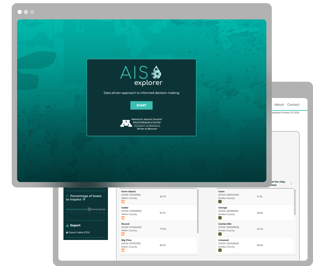
Easy access to risk models that empower biosecurity agencies to make better decisions
Aquatic invasive species (AIS) managers are tasked with preventing the spread of unwanted organisms within complex environments, often with limited resources to do so. A data-driven approach to identify and prioritise waterbodies of high risk of invasion is needed to inform effective and efficient control programs.
Practical outputs built on cutting-edge science
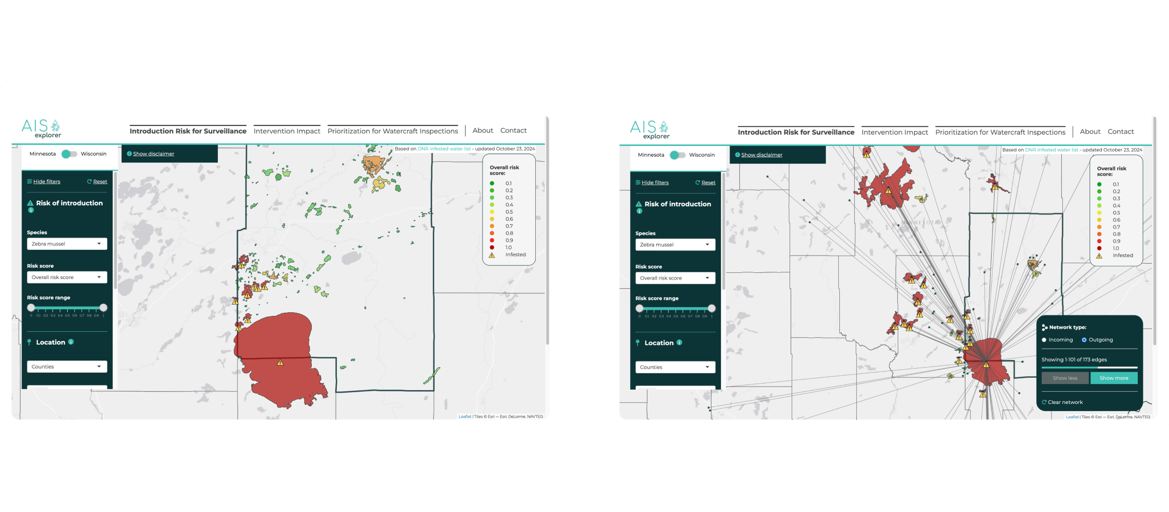
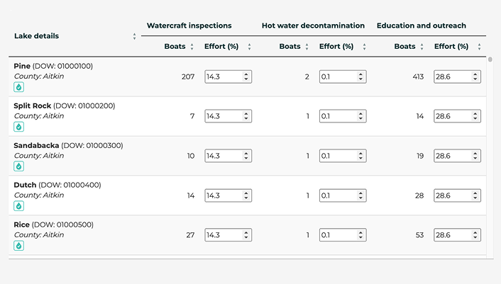
The AIS Explorer enables easy access to evidence-based guidance for effective monitoring of environmental health across thousands of water ways in Minnesota and Wisconsin. This includes guiding resource managers on ideal locations for watercraft inspection to optimise the use of limited resources.
Intelligence powered by research
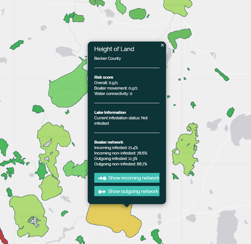
The AIS Explorer supports the development of county-level watercraft inspection plans that outline the optimal location of watercraft inspections for “risky” movements (leaving infested waterbody, arriving at uninfested waterbody) for each county.
Users are empowered to investigate the connections between lakes in different counties, where collaborative inspection planning could increase intervention efficiency. This helps decision makers place watercraft inspection stations where the impact is the highest.
Information for action
This project showcases how quantitative risk modelling, implemented in specialist software, can be directly linked with operational decision-making in biosecurity, and connect field work conducted by regional authorities with scientific insights in a timely manner.
Bringing together different data science tools
Lake status is regularly updated through an automated data pipeline built with R, Python and dedicated cloud infrastructure to ensure latest data and risk estimates are easily accessible and included in the analysis in a timely manner.
R Shiny is used for the complex visualisation, The app is hosted on EPI’s autoscaling hosting environment to ensure we can deliver a high performing app.
Making complex scientific outputs into intuitive visuals
To create a dashboard that distils complex analytical models into practical guidance it was critical that the information design of the application was highly refined.
To achieve this our software engineers collaborated closely with university researchers to identify which model outputs to prioritise and how best to enable users to interact with the model and choose for example lakes to be included, and spatial units of interest such as tribunary boundaries.
Outputs that are tailored to the user
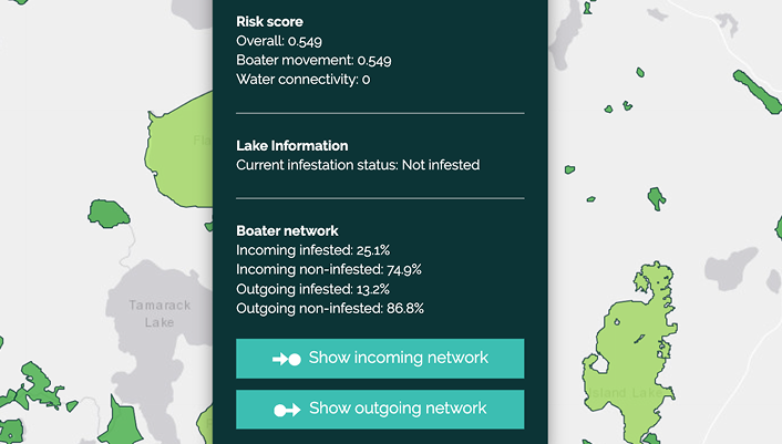
Users can assess the impact of different intervention scenarios on the risk of new infestations.
With each scenario, users can select different levels of effort, effectiveness, and cost; enabling users to evaluate the outcomes of different intervention plans within a specific aquatic ecosystem.
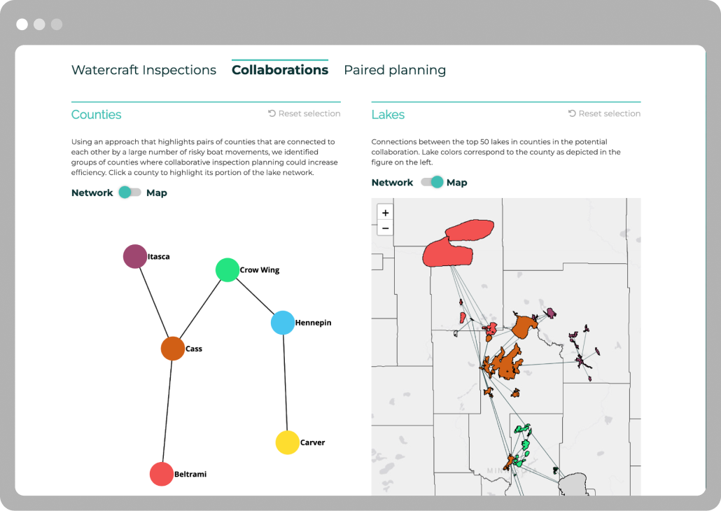
Identifying high-impact collaborations
Users are empowered to investigate the connections between lakes in different counties, where collaborative inspection planning could increase intervention efficiency.
This helps decision makers place watercraft inspection stations where the impact is the highest.
Supporting rapid response
Lake status is regularly updated through an automated data pipeline to ensure latest data and risk estimates are easily accessible.
This allows smart use of data for rapid detection and response to biosecurity threats in a practical and cost-effective way.
Publications
Kinsley A, Kao S-Y Z, Enns E A, Escobar L E, Qiao H, Snellgrove N, Muellner U, Muellner P, Muthukrishnan R, Craft M E, Larkin D J, Phelps N.B.D. (2024). Modeling the risk of aquatic species invasion spread through boater movements and river connections. Conservation Biology, e14260 (2024). doi: 10.1111/cobi.14260.
Available here
Kinsley A, Haight R, Snellgrove N, Muellner P, Muellner U, Duhr M, Phelps N.B.D. (2022). AIS explorer: Prioritization for watercraft inspections-A decision-support tool for aquatic invasive species management. Journal of Environmental Management, 314. doi: 10.1016/j.jenvman.2022.115037.
Available here
Angell N.R., Bajcz, A.W., Keller, R.P., Kinsley A.C., Snellgrove N, Muellner U, Muellner P, Phelps N.B.D. (2025). AIS Explorer: Intervention Impact—an application for planning more cost-effective AIS prevention programs. Biol Invasions 27, 234. doi:10.1007/s10530-025-03683-5.
Available here
Resources
Watch a webinar about the AIS Explorer, led by Prof Nick Phelps from the University of Minnesota.